North Branch
Interpreted North Branch of the Destor-Porcupine Fault Zone through the southern portion of the property.
Legacy Gold Project
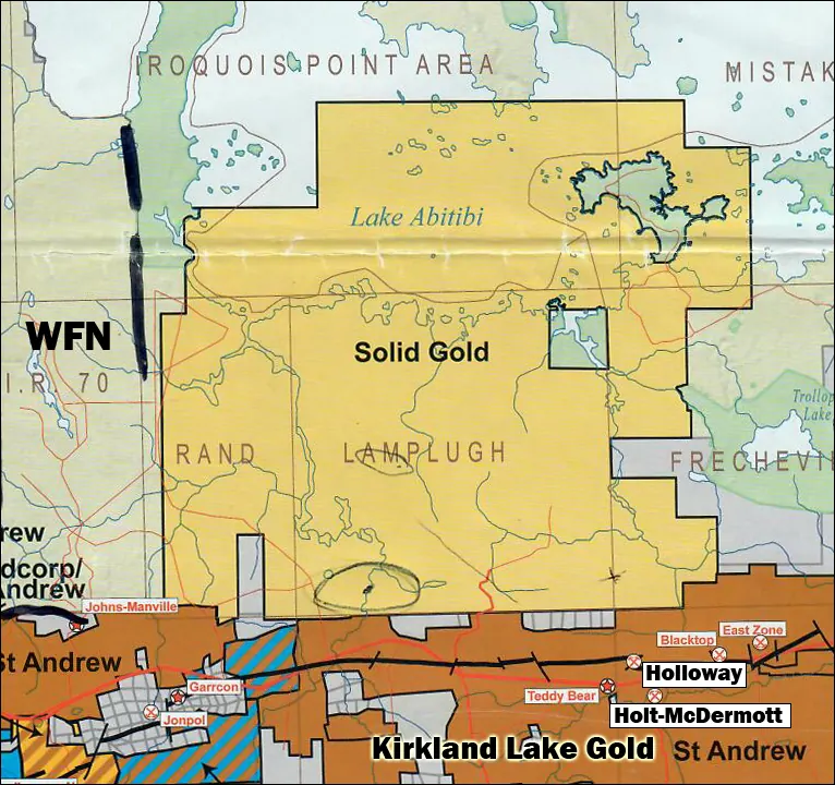
A contiguous mineral claim block in the Larder Lake Mining Division of northeastern Ontario, straddling the interpreted North Branch of the Destor-Porcupine Fault Zone immediately north of the Holt-Holloway mine complex.
Property Snapshot
| Project | Legacy Gold Project (Lake Abitibi Property) |
|---|---|
| Location | Lamplugh, Rand, Frecheville, Iroquois Point and Mistaken Islands townships, Larder Lake Mining Division, Cochrane District, Ontario |
| Nearest Town | Matheson, Ontario, approximately 45 km west along Highway 101 |
| Land Position | More than 20,233 hectares / 50,582 acres in the project summary; the 2026 transaction release describes over 21,000 hectares |
| Commodity | Primary: gold. Secondary: platinum-palladium potential at the Ghost Range layered mafic intrusion |
| Exploration Status | Historical geophysical, geochemical and initial drill testing programs have been completed; no material exploration has been undertaken since 2011 |
| Resource Status | No current NI 43-101 mineral resource or mineral reserve estimate |
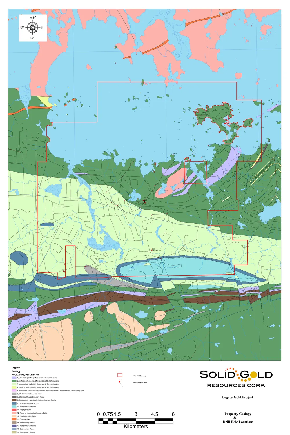
Regional Geology
The project lies in the Abitibi Subprovince of the Superior Province of the Canadian Shield. Gold production in the Kirkland Lake and Timmins-Porcupine camps is preferentially clustered along major deformation corridors, including the Destor-Porcupine and Larder Lake-Cadillac fault zones and related splays.
Mapped bedrock is dominated by steeply dipping, east-west trending Archean mafic to intermediate metavolcanic rocks. The Ghost Range mafic-to-ultramafic intrusive body forms a prominent ridge along the southern boundary of the property.
Structural Setting
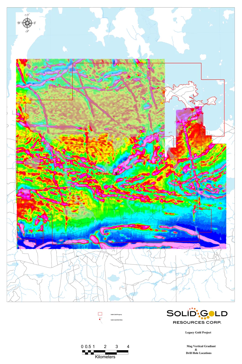
Ground and airborne geophysics interpreted four sub-parallel east-trending structural corridors across the property.
Interpreted North Branch of the Destor-Porcupine Fault Zone through the southern portion of the property.
Newly interpreted east-west structure under Lake Abitibi, identified from airborne magnetic data and ground surveys.
Parallel structure interpreted just north of the Tangcoh Fault.
Sub-parallel structure near the northern boundary of the property.
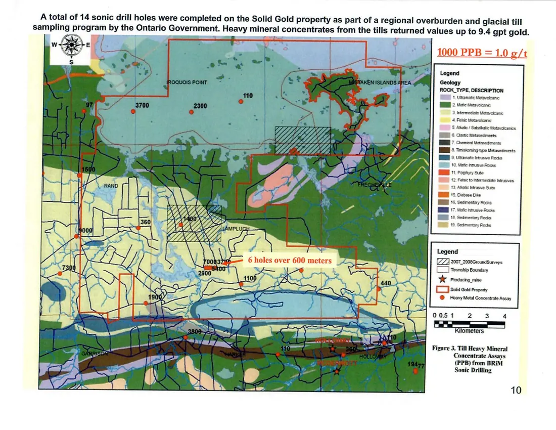
Historical Surveys
Ontario Geological Survey BRiM sonic drilling and till geochemistry identified anomalous gold values in basal till on and near the property. The website summarizes this historical information only at a general level.
Exploration Summary
The property has seen historical geophysics, overburden work and initial drill testing. Detailed historical results are not presented here as current technical disclosure.
Ground and airborne surveys outlined interpreted east-trending structural corridors, magnetic features and conductors for historical follow-up.
Regional government overburden programs and related interpretation contributed to the historical exploration model for the property.
Solid Gold completed initial diamond drill testing during the historical Phase 1 program, but no current mineral resource or reserve has been established.
The mineral property is not the subject of a current technical report prepared in accordance with National Instrument 43-101. Historical exploration results referred to on this website are historical in nature, have not been verified or updated by a qualified person, and are not being treated by Solid Gold as current.